
A Guide To Day Hiking Oregon’s Best Waterfalls- Sahalie and Koosah Falls Trail
Did you know there are at least 238 waterfalls in the state of Oregon?
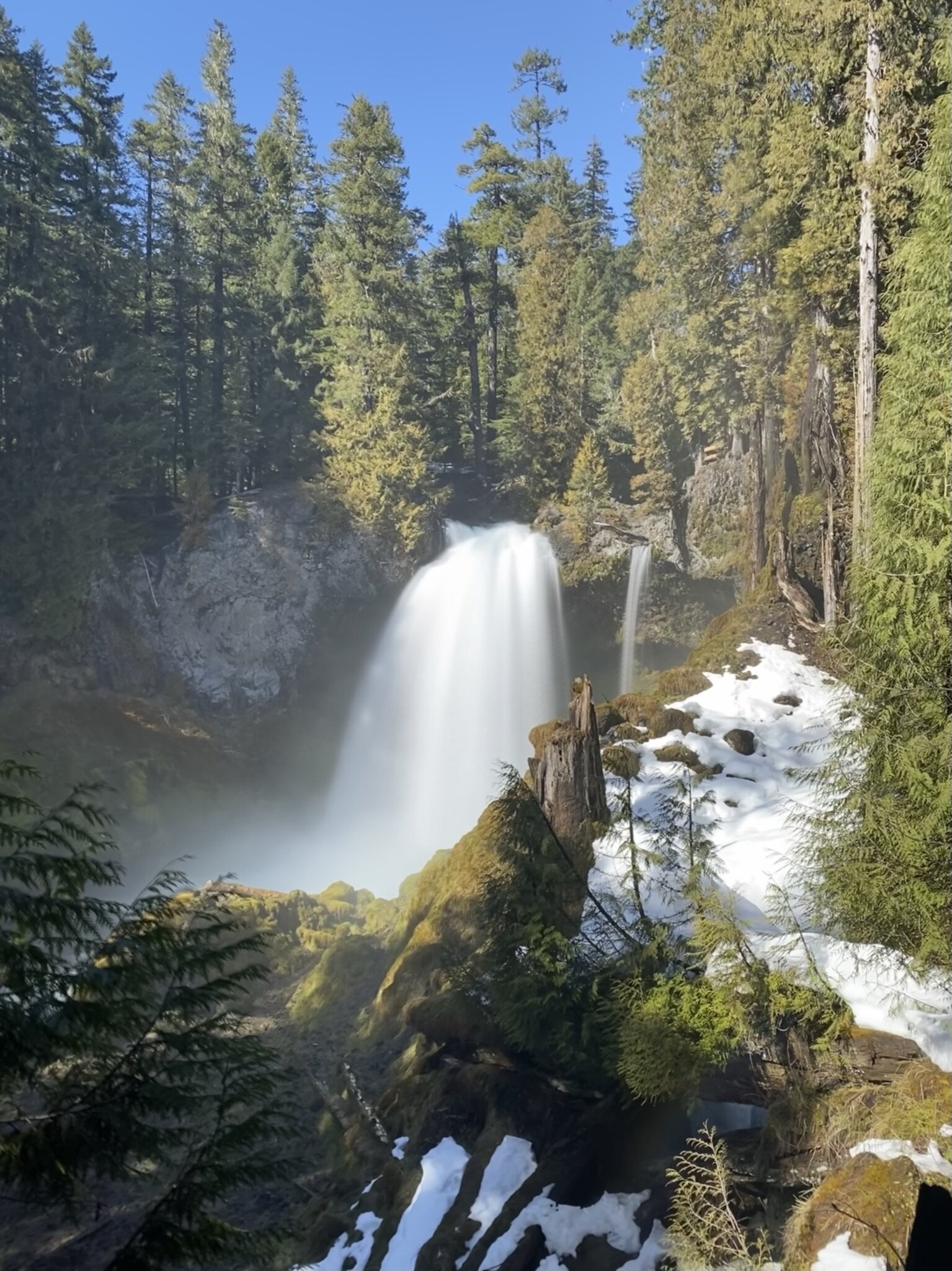
The Sahalie and Koosah falls trail is a gorgeous forested trail that features two waterfalls. Located off of Hwy 126 along the McKenzie River in the Cascade Mountains, they are closest to major city of Bend. Sahalie is a Chinook Jargon word meaning "heaven". Sahalie falls is 73 feet high. Koosah is a Chinook Jargon word meaning "sky". Koosah waterfall is slightly smaller at 64 feet high.
Sahalie and Koosah falls are some of the most accessible, gorgeous waterfalls I have ever experienced. They are a must see on your next road trip to Oregon.
In this blog post, you’ll find some general notes about the trail, stats for the hike, trailhead information, maps and GPSx links, and a full trail overview.

General Notes:
Always follow Leave No Trace guidelines.
Leave No Trace is a set of guidelines that helps promote the protection and preservation of wilderness. Find detailed information about how to practive Leave No Trace by clicking here.
Willamette National forest has had fires in recent areas and is subject to forest closures. Check to make sure the area is currently open.
The USFS link here will have current status updates for this trail. Make sure the area is open to hiking before heading out on the trail. Additionally, this site will have in depth information about Willamette National Forest current conditions.
A note about the route.
Each waterfall has its own parking lot and you can see them within a short walk from the lots. This route describes the 2.5 mile loop to see both falls. Hiking the trail is certainly more rewarding than just hoping out of the car at each viewpoint, but if you’re limited on time or simply don’t want to hike the whole trail, this is an option.
You can also start at either Sahalie falls or Koosah falls. I recommend starting at Sahalie and hiking the trail to Koosah falls.Always tell someone your plan.
Make sure someone knows your plan to day hike and has an estimated time for your return. Click here to download a printable emergency hiking form so you can leave all the important details with someone.
Make sure you pack your 10 essentials.
Click here to download a printable day hiking checklist. For more information on the 10 essentials, click here.
Check the weather.
Before you head out on your hike, check the weather for the area by clicking here.
Trail Stats:
Miles: 2.4 miles round trip
Elevation Profile: ~350 ft. elevation gain
Trail difficulty: Easy
US Forest Service website: Click here
This hike is located in the McKenzie River Ranger District.
AllTrails link: Click here
Trail type: Loop
Permit: Not required for day hikes
Water: Recommend 1-2 L
McKenzie River access; water should be filtered before drinking
Best time of year to hike: March-October
The falls will be flowing the most in early spring. Winter access is limited and proper gear should be carried for winter travel.
Dogs: Yes, on leash
Trailhead Information
While you can technically start your hike at either the Sahalie parking area or the Koosah parking area, I recommend starting at Sahalie Falls.
Sahalie Falls Trailhead amenities includes a primitive (no flush) restrooms and trash cans. There is no cell service at the trailhead.
Koosah Falls Trailhead amenities include restrooms and trash cans. There is no cell service.
To get to the Sahalie Falls trailhead: Travel east on Highway 126. To access the Sahalie Falls parking lot, proceed another 1/2 mile north of the Koosah Falls turnoff on Highway 126. The parking area is located on the left.
Click here for the Sahalie Falls trailhead address.

a note from the Forest Service on winter conditions & parking
Maps and GPSx links:
Trail Overview:
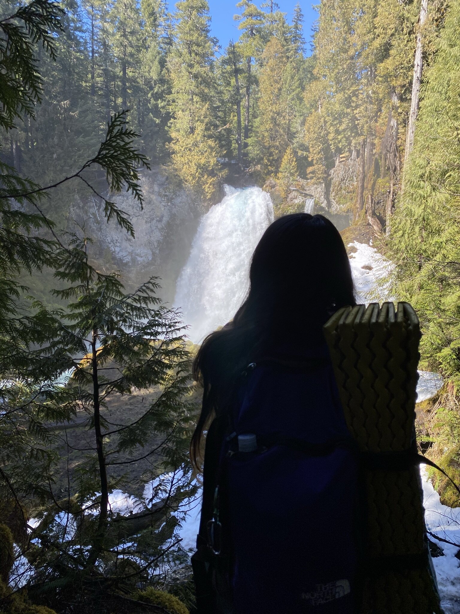
I hiked the Sahalie/Koosah Falls trail in March of 2021. The trail was covered in a decent amount of snow still, so I used Microspikes. The photographs in this trail overview have snow on trail!
You can start the trail from either parking lot, but I recommend starting at the Sahalie Falls parking lot.
From the parking area, Sahalie Falls viewpoint is only 100 ft. away on a paved, wheelchair accessible trail.

The viewpoint for Sahalie Falls is very popular due to its accessibility, so please be patient and mindful of other visitors.
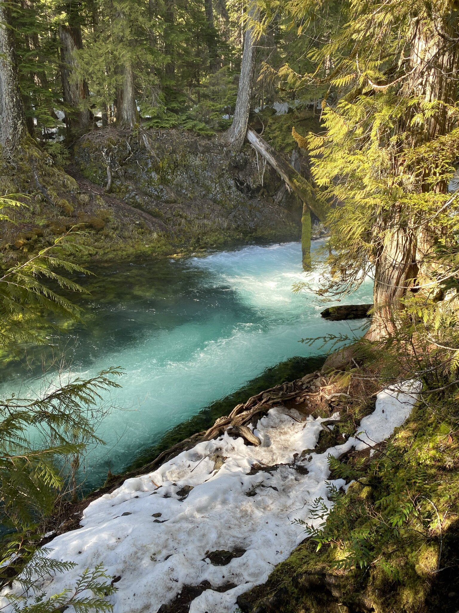
After you’ve soaked in the magic of Sahalie falls, you’ll follow the trail and walk downstream along the McKenzie river toward Koosah Falls.
The trail is gorgeous, and you’ll walk through a canopy of red-cedars, western hemlocks, and Douglas-fir trees. As you follow along the McKenzie river, there are several picturesque cascades that create a magnificent teal water color.
After you’ve hiked along the river for a while, you’ll eventually reach the first viewpoints for Koosah Falls. It’s worth it to continue walking along this trail until you get to this overlook.

Once you’ve taken in the views at Sahalie falls, you can continue along the trail. It will eventually cross over the McKenzie river, and continue on the other side. This gives you unique views of each of the falls, and eventually brings you back to the parking lot.
Once we finished our time at Sahalie falls, we opted to simply retrace our steps back to the parking lot, making it an out-and-back instead of a loop.